HIGHLY ACCURATE FLOOR PLANS, SECTIONS AND ELEVATIONS
CAN BE GENERATED IN A VARIETY OF FORMATS AND LEVELS OF DETAIL. THIS WAY WE DELIVER PRODUCTS TAILORED TO SUIT YOUR SPECIFIC REQUIREMENTS
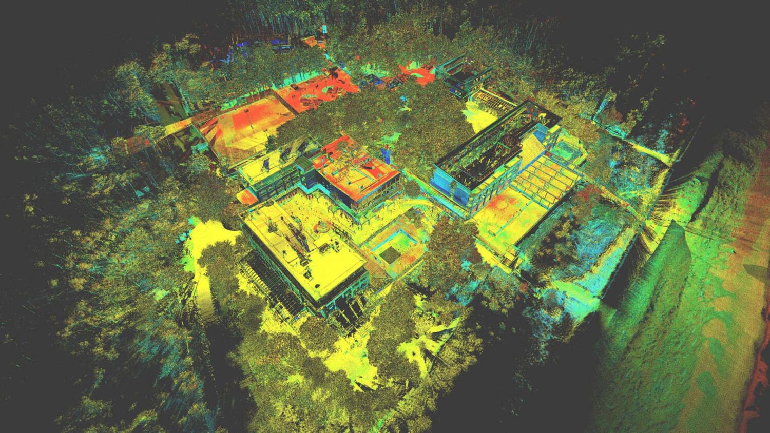
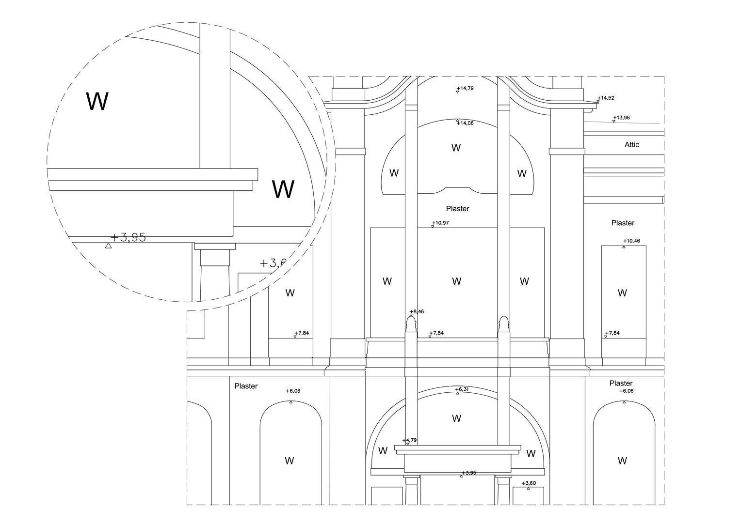
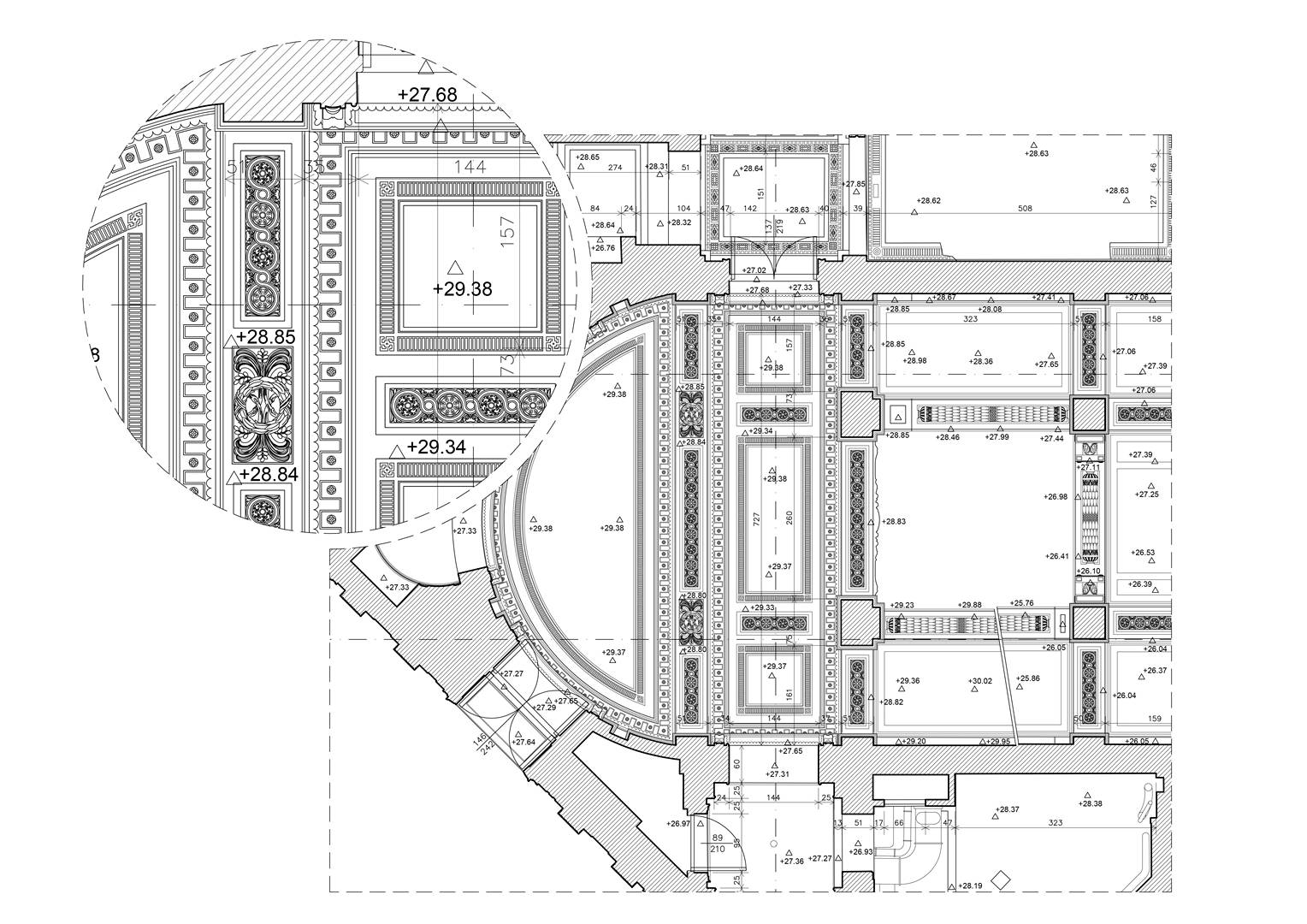
Utilising point cloud as a basis, we produce highly accurate and detailed 2D documentation. It contains precise products such as floor plans, sections and elevations views. When compared with traditional methods of survey data capture, point clouds offer a far greater flexibility in terms of data production. As with other data extraction projects, specification is all important. Time and therefore, cost savings can be achieved by understanding the level of detail and accuracy required, both today and in the future.
Specification will determine the density in the point cloud during the data collection stage, as well as the level of extraction for the final product. A little forward planning initially may save on costly and time consuming revisits to the site at a later stage. This will allow the end user to gain the maximum advantage from the use of point cloud technology. Our 2D CAD services include elevations drawings, floor plans drawings, sections and ceilings.
PRACTICAL APPLICATIONS INCLUDE:
Redevelopment of existing buildings
Streetscape elevations for planning
Heritage Recording


Project examples – 2d cad documentation:

Tenement building – Greater London
2D CAD documentation, 3D CAD models, Architecture & Constructions, Registered Point cloud-
As-Built verification and BIM modelling
2D CAD documentation, Architecture & Constructions, BIM -
Residential building in London
2D CAD documentation, Architecture & Constructions, Registered Point cloud -
Well of Saint John from Dukla
2D CAD documentation, 3D mesh models, Heritage, Registered Point cloud -
Boim Chapel
2D CAD documentation, 3D mesh models, Heritage, Registered Point cloud -
Old Slaughterhouse
2D CAD documentation, Heritage, Registered Point cloud -
Drifts in Wieliczka
2D CAD documentation, Heritage, Registered Point cloud -
The Teutonic Castle in Toruń
2D CAD documentation, Heritage, Orthophoto, Registered Point cloud -
Villa Zgorzelec
2D CAD documentation, Architecture & Constructions, BIM, Truviews -
Bryza Resort
2D CAD documentation, Topographical surveys, Truviews, Urban planning -
Newcastle School
2D CAD documentation, Architecture & Constructions, BIM, Registered Point cloud, Truviews -
Holy Trinity Church
2D CAD documentation, 3D CAD models, Heritage, Registered Point cloud, Truviews -
Uniejów Castle
2D CAD documentation, Heritage, Orthophoto, Registered Point cloud, Truviews -
Gdynia Railway station
2D CAD documentation, 3D CAD models, Architecture & Constructions, Registered Point cloud, Truviews -
Kuwait international airport
2D CAD documentation, Architecture & Constructions, Registered Point cloud, Truviews


