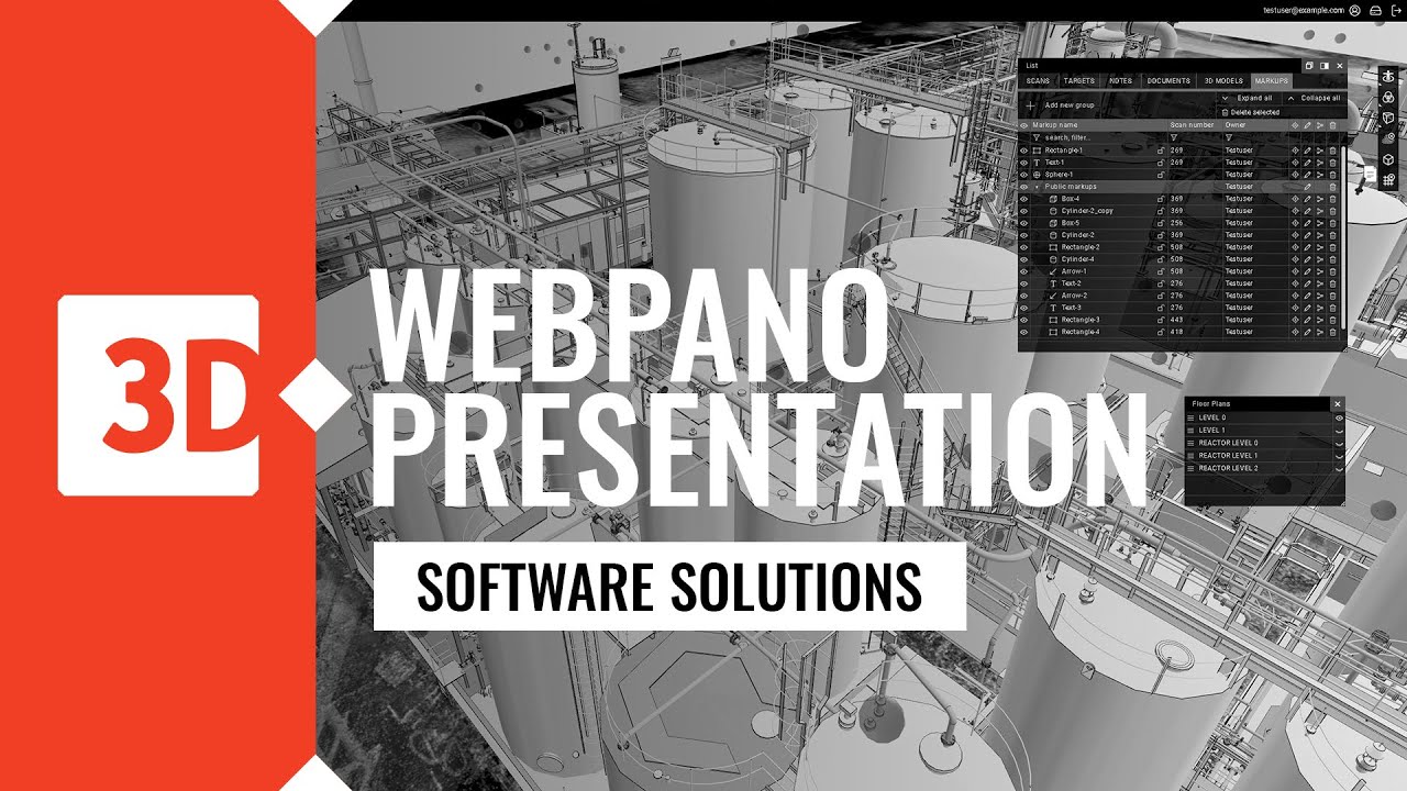
WEBPANO – CUSTOM DIGITAL TWIN SERVICE FOR SHARING AND VIEWING SCAN DATA AND 3D MODELS
WebPano is web-based service for viewing 360-degree panoramic images and scan data, which allows the user to take measurements and pick 3D coordinate values. The additional unique feature is viewing 3d models along with it’s attributes. WebPano allows for three view modes, panoramic (where scan data is available), 3d orbit and 3d walk (were 3d models and Panos hotspots are available). WebPano is designed to be used as a communication tool between managers and engineers, who can add their comments or highlight particular areas of interest.
The whole team can view, check and discuss the site situation from their office desk via any web browser without a need of installing any additional plugins. It allows even inexperienced users to take advantage of the 3D laser scanning technology and limits unnecessary site visits. WepPano scan images can be generated in intensity colors (black&white), or in the real color scale if scanned using the RGB option. This is an essential tool and aid in the CAD to cloud conversion.
REGISTER HERE TO GET ACCESS TO DEMO SITES:
WebPano for plant maintenance:

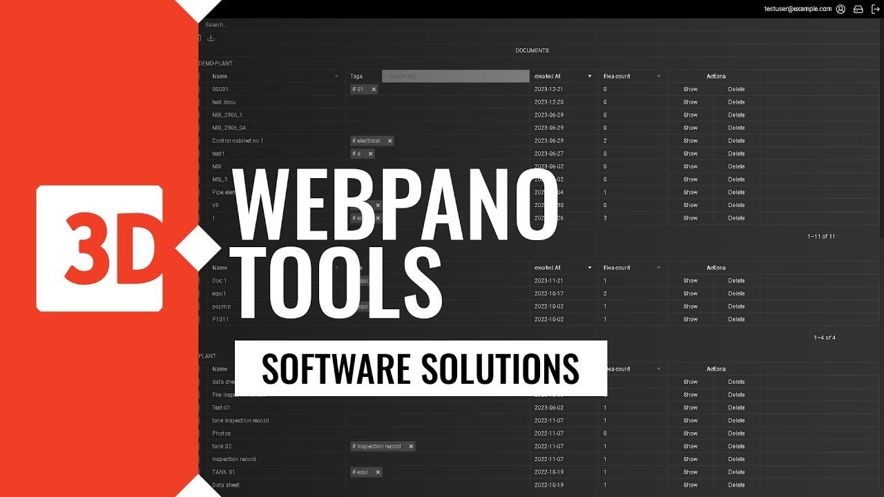
Knowledge and documentation hub
Organizations can either upload or link documents related to a virtual copy of an asset like specific equipment [pump or vessel]. This document could be a datasheet or maintenance log. Having it linked in Webpano interface simplifies access for new employees.
3D training and certification platform
The technical staff undergoes technical training using a virtual factory view, including hard-to-reach and hazardous areas. This training involves verifying the plant’s topography and understanding procedures, especially in emergency situations.
Procurement support
Procurement engineers can easily digitally share the area for modernization with project and execution companies, thereby reducing the involvement of their own employees. As a result, project and execution companies can more precisely determine costs and effectively manage modernization.
Risk analysis for business continuity planning
The management has a supportive tool for more efficient discussions with the staff about potential risks that pose the greatest threats to operational continuity. Engineers can visually indicate areas and objects that require special care and procedures.
Asset inventory tool
Maintenance engineers can inventory facility devices and objects by easily linking them to their geolocation and documentation stored in other database systems.
As a result, they build a knowledge base that is easily accessible for new employees, allowing them to quickly adapt to new responsibilities, while also making it easier for engineers to manage inspections and maintenance.
Internal audits and checks
Inspection of installations, equipment checks, and internal audits are conducted with automatic tagging of the location where they were performed. Linking geolocation with radio frequency identification (RFID) of installation elements allows for easier and faster marking of these elements as verified, along with providing information about any necessary additional actions.
Thanks to this process, engineers can efficiently monitor the condition of equipment and take appropriate actions as needed. The automatic tagging of the inspection location, along with geolocation and documentation linkage, facilitates infrastructure management and maintenance.
WebPano for plant process design
Point Cloud Publishing Platform
You can publish point cloud data that has been collected at various stages of investment projects and comes from different sources. This allows you to build a shared platform for reviewing and sharing this data online, with appropriate security level.
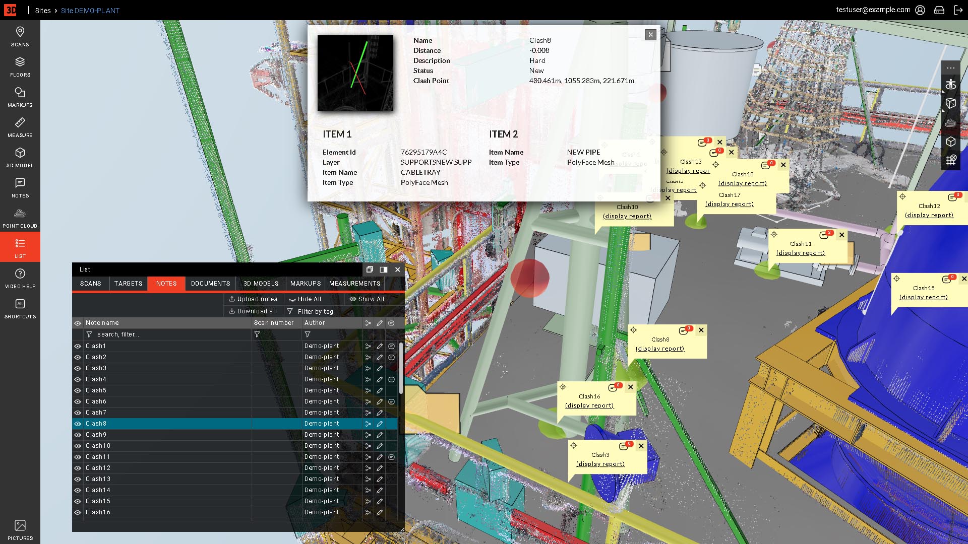
Clash verification platform
Clashes detected during the execution phase generate additional high costs for necessary modifications. Ordering a service clast detection you receive a comprehensive report of potential geometric collisions, which we verify for you by comparing the placement of designed objects on the existing model of the current installation, which are placed in WebPano browser.
3D model integration
The necessity of using multiple different programs for reviewing and editing documentation related to facility infrastructure generates high costs for overseeing electronic documentation. Sharing panoramas, 3D models, and point clouds within a single browser eliminates the need to purchase and install additional software for viewing 3D models.
Cooperation tool for project stakeholders
Project participants easily communicate by tagging and commenting on selected objects and installation components, adding notes, comments, and documents. These are then shared online through a browser. This helps avoid misunderstandings and communication issues. By streamlining communication and centralizing documentation, you can enhance collaboration and efficiency within your project.
Point Cloud Clips and sharing
The point cloud manager can select and annotate an area (such as a specific object or part of an installation) and share it with designated individuals. Additionally, they can attach data files from the marked scanning points. This streamlined process enhances collaboration and facilitates effective communication among project stakeholders. By providing access to relevant data and visual representations, the point cloud manager ensures that everyone is on the same page, minimizing misunderstandings and improving overall project efficiency.
BENEFITS OF USING WEBPANO:
Flexibility
Currently supported model formats: DXF, PDMS, IFC
Easy navigation
Floor plan list with each sitemap
Accuracy
linear and spatial measurements right away
Visibility
3D Model views
Tailorability - Increased Perceived value
Unlimited options for client customizations
Clarity - Efficient communication
Notes and comments for project teamwork
Increasing efficiency of launching process
Streamlined Deployment and Error Cost Reduction by clash analysis
Project stakeholders time savings
Options for hosting at clients servers
Interoperability
Access to model attributes if available in the model
Safety during project data sharing
Unique secure logins
Management supervision
Advanced manager list
More functionalities coming soon
Webpano shorts
Access from anywhere via any web browser

HD 360 image, point cloud, 3D model
Display mode: Panorama to 3d orbit
Display mode: Panorama to 3d walk
Floorplans to 3d orbit
Split window
Access to the model tree
Attributes of the model elements
Spatial measurement
Linear measurement
2d markup
3d markup
Adding documents
Adding notes
Notes searching by tag
Sharing notes
Clipping point cloud
WEBPANO presentation VIDEOS: